Satellites are useful in lots of ways. They look at the Earth as well as space. They also help us in our the daily lives.

- Communications
Satellites in space allow us to share information across the whole world. The signals used by TV and mobile phones use a type of light called radio waves.
Radio waves can travel long distances but only in a straight line. This means they can't go around the curve of the Earth. So we can't send these signals along the ground to other side of the globe. Instead, we send the signal up to a satellite in space.
The satellite then sends the signal back down to Earth. If you live or work in a remote part of the world, satellite phones and Internet are vital.
- Navigation and Industry
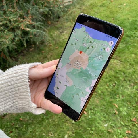
If you want to find your way to a new place what do you do? You probably use a map app on a phone or a sat nav in a car. These use the Global Navigation Satellite System (GNSS). This is a group of satellites which work together in space. Mobile apps use the GNSS to work out the distance between your phone and a few of the satellites. It then uses this data to work out where you are in the world! Planes and ships use these accurate sat nav systems to avoid collisions.
Did you know a network of satellites like the GNSS is known as a 'constellation'?
Even banks need satellites. Banking computer systems need a single, precise time for each payment someone makes. The GNSS acts like a giant watch in space. Each satellite has a high precision atomic clock on board. Satellites help machines around the world agree on exactly what time it is. This helps keep banking safe and prevent fraud.
Did you know clocks on satellites move quicker than ones on the Earth? Einstein's Theory of Special Relativity explains why. The GNSS has to take this into account.
- Weather & Climate
The weather affects our lives each day, so we need reliable weather forecasts. They help us to plan our activities and decide what to wear. Extreme weather can cause flooding, wildfires, droughts or hurricanes.
These types of weather put people's homes, businesses and lives at risk. So accurate weather forecasts can save lives. Bad weather can be a huge problem for industries like farming, fishing, construction and tourism. They rely on forecasts to plan their activities.
Weather forecasts use computers and lots of data to predict what's going to happen. They rely on the correct data coming from satellites measuring the Earth’s atmosphere and surface. The first weather satellite was Tiros 1 which launched on 1st April 1960.
Climate is not the same as weather. When we speak about climate, we think about the whole world. It is large-scale and long-term.
Changes to the Earth’s climate can happen naturally. Large storms coming from the Sun and volcanic eruptions on Earth affect the climate. Scientists agree the Earth's climate is now changing because of humans. Satellites measure the temperature of the Earth and the amount of greenhouse gases in the air. They also collect data on the amount snow, sea ice and plant cover. These measurements help to monitor and predict changes to the Earth’s climate.
Image CreditThis work by The Met Office is licensed under Creative Commons Zero v1.0 Universal
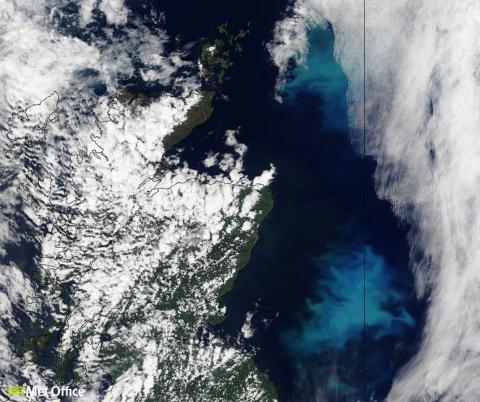
Phytoplankton blooms in the North Sea - Observing Earth
Over 70% of the Earth's surface is covered in water. Satellites are used to collect lots of information on the seas and oceans. The height of sea levels and waves, the temperature of water, and the direction and strength of ocean winds are all measured.
Photos taken from space show the amount of land covered in forests or crops, or covered by roads and buildings. Satellites also measure the amount of pollution in the air.
The information from satellites is used to learn more about our planet and the environment. Scientists compare the data collected around the world, or in the same place at different times. This lets them work out how the environment today has changed to that from 5, 10 or 20 years ago. It also helps them work out why changes have taken place and predict what might happen in the future.
